Sunday, August 11, 2013

Canyonlands, UT to Bryce Canyon, UT

Deadhorse Point State Park, UT
to Bryce Canyon, UT
Waypoint 36 to waypoint 41

There sure are some remote places in this area of the country. Most of the roads are good but there were a few we sort of wished we had taken a different route. When you are 55' long mountain driving gets trying after a few hours of it. May snowflakes and high ground gets one wondering if another way might have been better. Still, no real regrets. As always the Chevy performed flawlessly and got us where we needed to be.
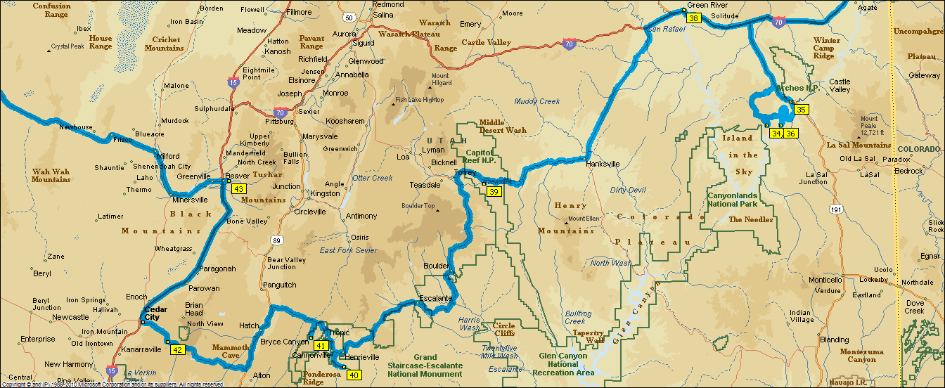


As can be seen from the map there is not a whole lot of flat land in this area. Roads tend to twist and turn in the valleys but there are some serious passes to go over.

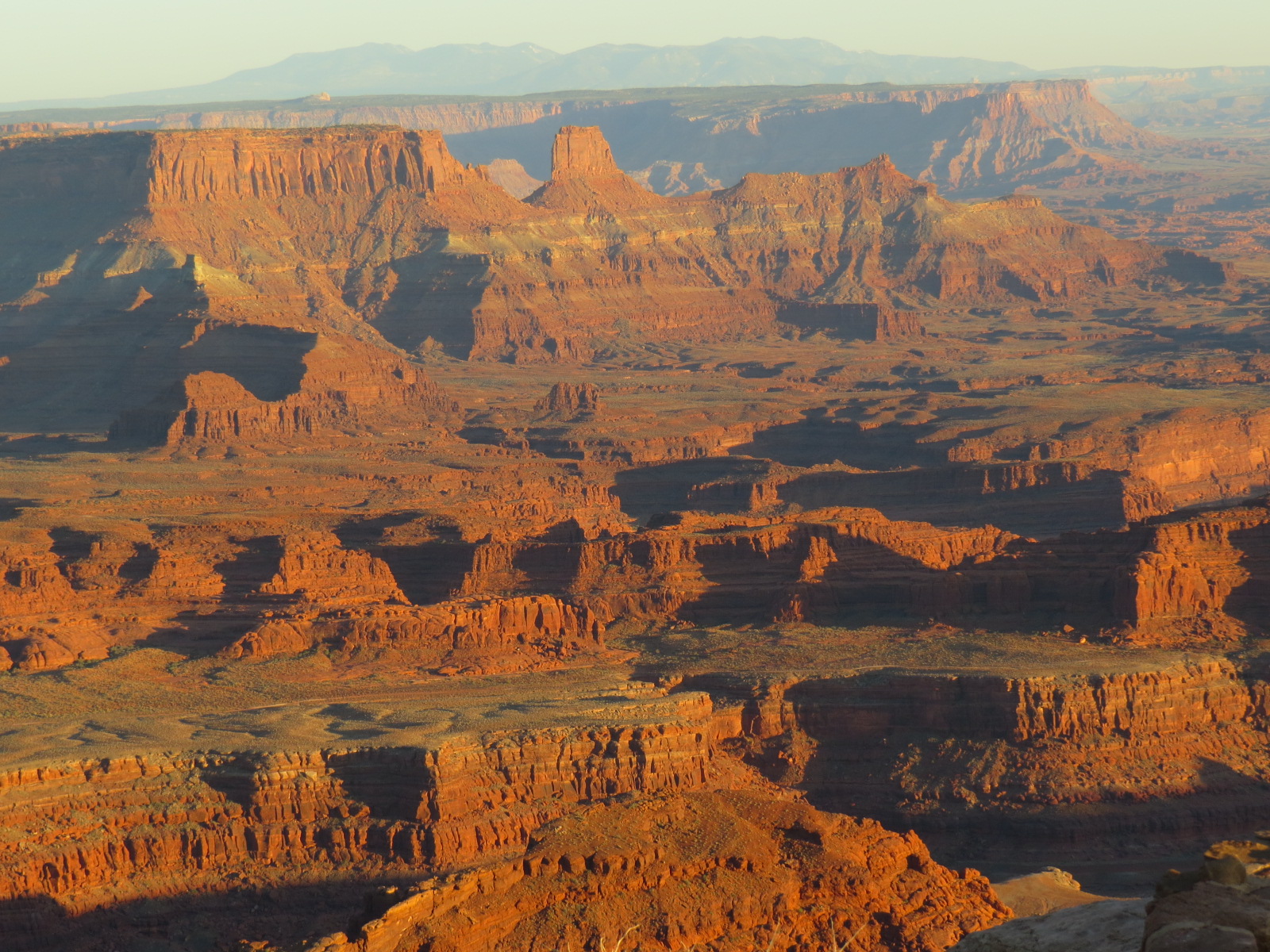
I'll start off with a few more pics from Dead Horse Point State Park. The sunset colours are quite something. Dead Horse is nowhere near as well known as the Grand Canyon and nowhere near as close to a major city. We like it so much this is our fourth visit.


All of these shots were taken on the same sunset at 
Dead Horse Point overlook. Incredibly we had the
area almost all to ourselves. 


Yeah, it was that cold. No wind but the temp quickly drops
to the 50s or high 40s


You look at this and in the silence you go WOW, just WOW!


Our campsite at Dead Horse. Tight fit.


On the road between the Canyonlands/Moab area, WP36 and Kodachrome Basin 
State Park, WP 40, the geology never remains quite the same for long.


Sure, we could have taken the interstate and saved time and fuel 
but we would have missed all of this.


And you had better pay attention to signs like this. 


Most of the through the windshield road shots are taken with 
a trusty little point and shoot camera


Kodachrome State Park, UT


We drove miles on a bumpy dusty dirt road to see a big rock. Oh well.


Kodachrome Basin State Park


A ranch beside the road to Kodachrome


Long silent paddocks


I'll bet this is a photographers delight at sunrise or sunset.


Cannonville near WP 40


Bryce Canyon Nat Pk


Bryce is another lesser known canyon. It is a decent drive from Vegas and
the round trip cannot be done in a day. A full day is needed to do the basic view.


No luck for us this time, our 4th visit. We figured on a full day.
What we got was cold, cloud, even a little rain.
We spent the day in the trailer.


Better luck next time. These pics are from last year.


Northeast New Mexico, Colorado to Canyonlands National Park, Utah


Northeast NM to
Canyonlands Nat Pk, UT
Waypoint 27 to 36
Note: Not all waypoints are overnights.
Some are created to force the software to 
take the desired route 

Turning west off of hwy 297 N of Amarillo, TX towards NM the traffic volume goes from light to extremely minimal. Forget receiving an over the air radio station. They are few and far between from here to the other side of the Sierra Nevada mountains in CA. Satellite Radio is our company.

Click on map & pics to enlarge to full size.


WP 27 Capulin Mountain, NM

Enlarge & look carefully. 
There is a town out there


Looking down into the crater of a long extinct volcano
The carpark is near top center. The dot is our truck.

WP 30 Colorado, Sand Dunes National Monument area


On the hoof for the next photo op always keeping 
an eye out for rattle snakes.


Sand Dunes. Over 300' high. That is way higher than Gibbs
for the Bermudians looking. WP 30


WP 30. No, not ants. Energetic people hiking


Carolyn takes a stab at black and white photography. 
The few photographers on the list might appreciate it 


Too bad we did not have clearer skies for these.
Oh well


Pretty much just us the ground squirrels, a few rabbits & the coyotes howling.


Just like boating. You never let the weather win.
Even if it is a little breezy and in the 40s, 
you must have the fire.


WP 30. Does it get any better than this?


Somewhere between WP 31 and 32


Near the top of Slumgullion Pass, CO. One wicked vehicle testing pass. 
Brake pads were literally smoking when we got to the bottom at Lake City, 
something like a 3000' drop in road level in very few miles.


Colorado high country


Mine tailings


North of WP 32, Lake City


North of Lake City


View from Dead Horse State Park Visitors Center


Dead Horse Point State Park, UT, WP 36


WP36. Part of the road to the top of the
Canyonlands mesa. A 3 mile 8% grade.


Dead Horse Point State Park, UT. Colorado River below.
Half the depth of the Grand Canyon but no less impressive.


Headed down to Pucker Pass. Yes, it IS a two way road.


Pucker Pass


Down from Pucker Pass


Rockface


Weathered tree stump


The Colorado winds through Dead Horse Point State Park


Dead Horse Point State Park, UT


A Dead Horse Point campground sunset


Canyonlands. The fishing vest carries camera stuff very nicely


WP36, Grand View Point overlook, Canyonlands NP, UT


WP36, Grand View Point overlook, Canyonlands NP, UT


WP36, Grand View Point overlook, Canyonlands NP, UT


WP36, Grand View Point overlook, Canyonlands NP, UT
The two dots near center bottom are vehicles


Indian Paintbrush, Canyonlands


 All pics are 'as is' out of the camera. Wish I had a polarizing filter for some of them to clear up some of the haze & make the colours as rich as they looked through polarized sunglasses.